Mayor Adams Unveils $10 Million Platform to Map NYC’s Underground
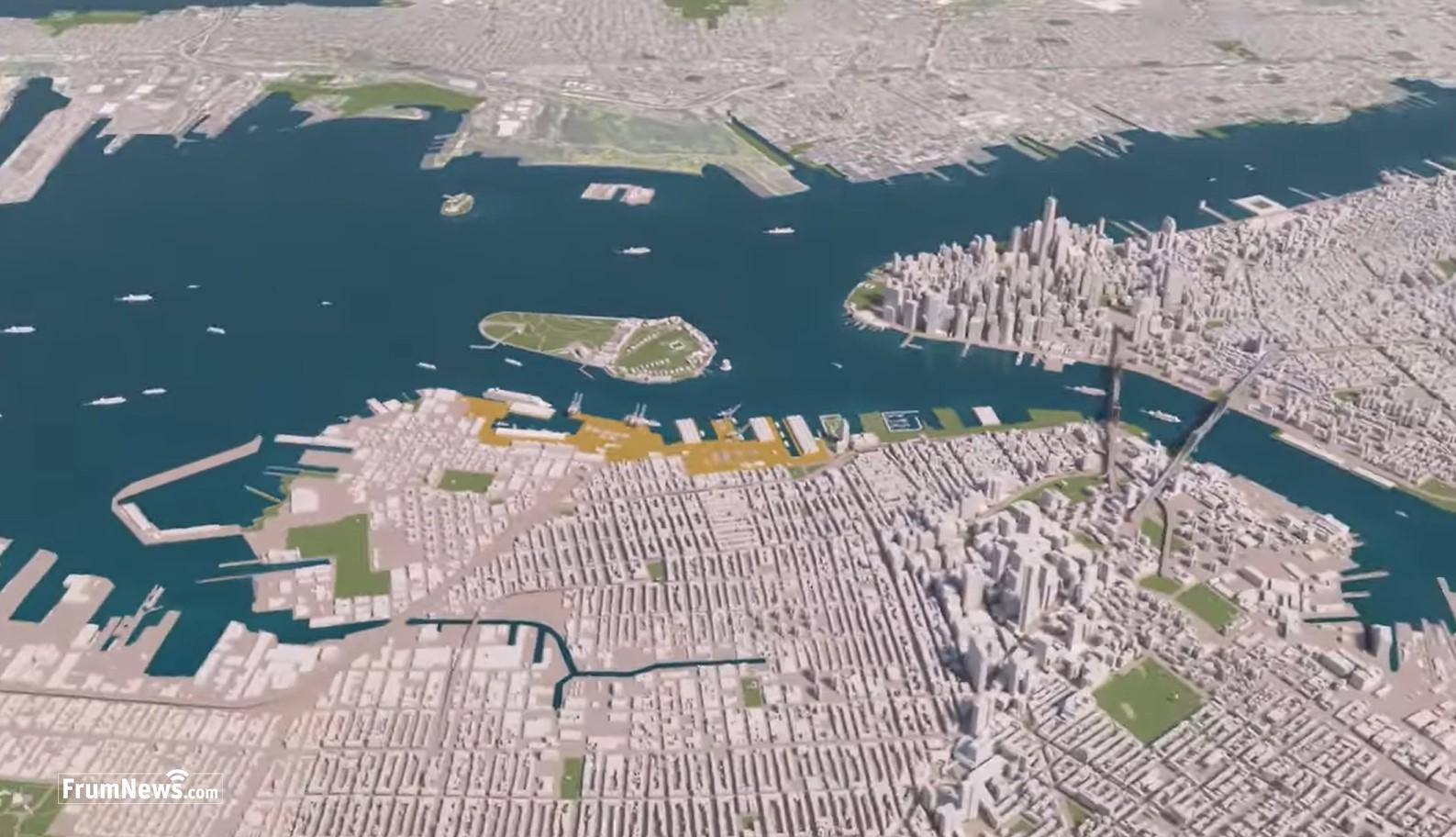
NYC Mayor Eric Adams announced the launch of 3D Underground (3DU), a cutting-edge program to develop a highly secure, 3D-data-sharing platform for New York City’s underground built and natural environment.
Brooklyn — NYC Mayor Eric Adams announced the launch of 3D Underground (3DU), a cutting-edge program to develop a highly secure, 3D-data-sharing platform for New York City’s underground built and natural environment.
According to the mayor’s office, the platform will enable government agencies and utility companies to share securely and access information about what lies beneath New Yorkers’ feet, including water and sewer pipes, gas lines, electrical conduits, fiber optic cables, and soil composition.
Born out of lessons learned during the recovery from the terror attacks of September 11, 2001, in Lower Manhattan, the idea for the 3DU initiative was born after 9/11 to meet the critical need for precise mapping recognized during those efforts, including the detection and remediation of dangerous freon tanks.
Adams said the platform will be designed to enhance the city’s ability to respond to emergencies, analyze emerging threats, and effectively plan and deliver capital projects.
“Keeping New Yorkers safe doesn’t just mean understanding what is happening above ground, but also what is happening below ground,” said Mayor Adams. “The web of pipes, cables, and lines that are below our feet are crucial in helping our city run and respond in emergencies, and, for too long, the city has not had a complete picture of how all these pieces work together.”
-
 Photo: NYC Mayors office
“Today, we are launching a groundbreaking $10 million initiative that will allow the city and its partners to anticipate delays in construction and improvement projects, while also enabling the city to better respond to emergencies,” the mayor added.
As part of this effort, the New York City Office of Technology and Innovation will create a comprehensive map of the city’s soil by digitizing geotechnical reports already submitted to the New York City Department of Buildings and partnering with Columbia University to estimate what the soil is like in areas without direct data. Understanding soil composition is important for planning construction projects, maintaining infrastructure, managing stormwater, and anticipating and responding to emergencies. The city will also start collecting soil samples digitally to make the underground soil model even more accurate over time.
Key goals of 3DU include:
- Improving emergency response and preventative threat analysis capabilities for underground infrastructure failures.
- Modernizing capital project planning and delivery through better data sharing to reduce costs and schedule overruns.
- Supporting climate adaptation and stormwater management.
- Minimizing disruption to businesses, residents, and transit.
Funded through a $10 million U.S. Housing and Urban Development (HUD) Community Development Block Grant for Disaster Recovery in the wake of Hurricane Ida, the city anticipates launching the platform for users in early 2028. The platform will leverage an earlier mapping effort that included ground scanning, conducted by the city in partnership with utility companies and New York University’s Tandon School of Engineering.
Read Next trending_flat
 Boro Park
Governor Hochul Announces New Light Rail In Boro Park, Flatbush And Crown Heights Has Entered Active Phase
 News
News
Post the first comment!